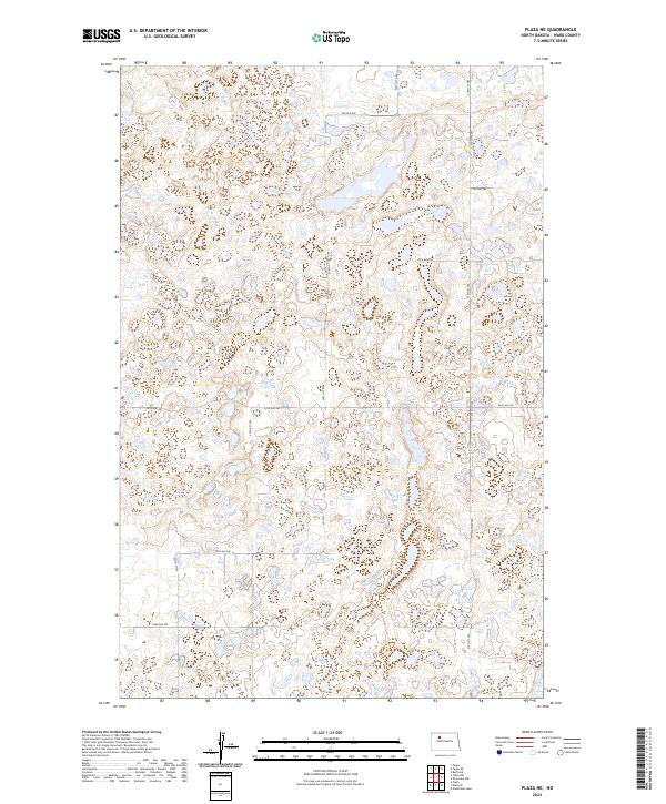
2024 Map of Plaza NE
USGS Topo · Published 2024About this map
Glacial potholes and prairie wetlands define this corner of Ward County, where the scattered units of the Ward County Waterfowl Production Area protect a critical landscape for migratory birds. This 2024 survey documents a region dominated by these seasonal and permanent water bodies, which are woven between a grid of rural sections. Navigation across the prairie is maintained by a network of local connectors including Co Rd 5 and various township roads like 338th St SW and 4th Ave NW. The terrain is characterized by the rolling topography of the Missouri Coteau, where the lack of an integrated drainage system has created hundreds of small depressions. While large settlements are absent, the map provides a precise look at the modern rural infrastructure and public lands that manage the natural prairie potholes of the Northern Plains.
Find a feature on this map
18 named features on this map. Tap any name to fly to it.
Don’t see what you’re looking for? This feature index may not catch every label — zoom into the map to look around manually.
Map Details
Editions of this 2024 Plaza NE Map
This is the sole edition of this map. No revisions or reprints were ever made.
Other maps of this area

1954 · Minot
USGS Topo · 1:250,000

1958 · Minot
USGS Topo · 1:250,000

1980 · Minot
USGS Topo · 1:100,000

1980 · Plaza SE
USGS Topo · 1:24,000

1980 · Rice Lake NW
USGS Topo · 1:24,000

1980 · Tagus SE
USGS Topo · 1:24,000
1980 · Plaza
USGS Topo · 1:24,000
1980 · Berthold
USGS Topo · 1:24,000
1980 · Underdahl Lake
USGS Topo · 1:24,000

1980 · Tagus
USGS Topo · 1:24,000