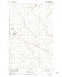
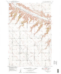
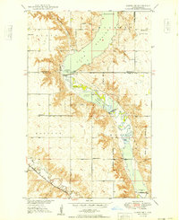
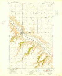
1980 Map of Berthold
USGS Topo · Published 1981About this map
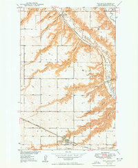
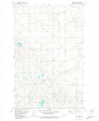
Berthold and Lonetree serve as the primary hubs of activity in this Ward County landscape, where the grain-growing plains are dissected by a series of drainage coulees. The path of the Burlington Northern railroad dictates the orientation of these settlements, running parallel to the southern edge of several large coulees. This map reveals a region transitioning between traditional agriculture and modern industrial development, indicated by the presence of a dedicated Oil Field and an infrastructure of pumping stations and pipelines.
Find a feature on this map
19 named features on this map. Tap any name to fly to it.
Don’t see what you’re looking for? This feature index may not catch every label — zoom into the map to look around manually.
Map Details
Editions of this 1980 Berthold Map
This is the sole edition of this map. No revisions or reprints were ever made.
Other maps of this area
1949 · Hartland
USGS Topo · 1:24,000
1949 · Carpio NE
USGS Topo · 1:24,000
1949 · Carpio
USGS Topo · 1:24,000
1950 · Des Lacs
USGS Topo · 1:24,000

1954 · Minot
USGS Topo · 1:250,000

1958 · Minot
USGS Topo · 1:250,000
1980 · Minot
USGS Topo · 1:100,000
1980 · Rice Lake NW
USGS Topo · 1:24,000
1980 · Tagus SE
USGS Topo · 1:24,000
1980 · Mork Lake
USGS Topo · 1:24,000