
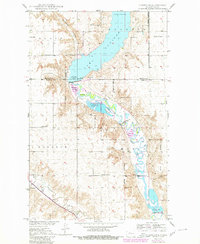
1949 Map of Carpio NE
USGS Topo · Published 1949About this map
Water management and wildlife conservation define this 1940s landscape along the Renville Co Ward Co border. The Upper Des Lacs National Wildlife Refuge dominates the northern terrain, featuring a series of controlled water bodies including Pond A, Pond B, and Pond C, which manage the flow of the Souris River. This complex system of dikes and spillways, such as Dam No 83 and Dam No 87, illustrates the early federal efforts toward habitat restoration in the Missouri River Basin.
Find a feature on this map
22 named features on this map. Tap any name to fly to it.
Don’t see what you’re looking for? This feature index may not catch every label — zoom into the map to look around manually.
Map Details
Editions of this 1949 Carpio NE Map
2 editions found
Other maps of this area

1948 · Burlington
USGS Topo · 1:24,000

1948 · Lansford
USGS Topo · 1:62,500

1948 · Burlington
USGS Topo · 1:62,500

1948 · Lansford SW
USGS Topo · 1:24,000

1949 · Burlington NW
USGS Topo · 1:24,000

1949 · Lansford SW
USGS Topo · 1:24,000

1949 · Carpio
USGS Topo · 1:24,000

1949 · Grano SW
USGS Topo · 1:24,000

1949 · Grano
USGS Topo · 1:24,000

1950 · Lansford
USGS Topo · 1:62,500