
1980 Map of Tagus
USGS Topo · Published 1981About this map
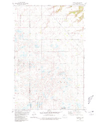
Tagus serves as the central hub of this prairie landscape, situated along the Burlington Northern railroad line at the junction of Ward and Mountrail counties. The area is defined by a dense concentration of glacial potholes and wetlands, many of which are preserved as part of the National Waterfowl Production Area. These numerous water bodies, including Carpenter Lake in the south, create a complex drainage pattern across townships like Stave, Kickapoo, and Evergreen. Local history is anchored by St Olaf Cem and several Gravel Pits, which point to the region's agricultural and resource-based economy during the late twentieth century. The terrain is partitioned into named sections such as Passport and Egan, reflecting the traditional township and range grid system used to organize this North Dakota wheat-country territory.
Find a feature on this map
17 named features on this map. Tap any name to fly to it.
Don’t see what you’re looking for? This feature index may not catch every label — zoom into the map to look around manually.
Map Details
Editions of this 1980 Tagus Map
This is the sole edition of this map. No revisions or reprints were ever made.
Other maps of this area

1949 · Hartland
USGS Topo · 1:24,000

1953 · Williston
USGS Topo · 1:250,000

1954 · Minot
USGS Topo · 1:250,000

1957 · Williston
USGS Topo · 1:250,000

1958 · Minot
USGS Topo · 1:250,000

1980 · Minot
USGS Topo · 1:100,000

1980 · Tagus SE
USGS Topo · 1:24,000
1980 · Aurelia
USGS Topo · 1:24,000
1980 · Plaza NE
USGS Topo · 1:24,000
1981 · Palermo NE
USGS Topo · 1:24,000