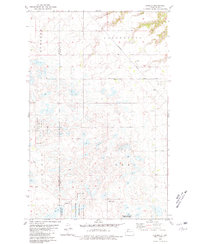
1980 Map of Aurelia
USGS Topo · Published 1981About this map
Aurelia sits at the intersection of prairie agriculture and transport in the late 1970s, serving as a focal point along the Burlington Northern railroad line. This survey, based on 1973 photography, illustrates a landscape defined by the drainage patterns of Shipton Coulee and Jack Power Coulee in the northern reaches of the quadrangle. The presence of the Moravian Cem and a local Townhall indicates the established social fabric of this rural community, while numerous Gravel Pit sites suggest an economy supported by local resource extraction.
Find a feature on this map
17 named features on this map. Tap any name to fly to it.
Don’t see what you’re looking for? This feature index may not catch every label — zoom into the map to look around manually.
Map Details
Editions of this 1980 Aurelia Map
This is the sole edition of this map. No revisions or reprints were ever made.
Other maps of this area

1947 · Tolley
USGS Topo · 1:62,500

1948 · Donnybrook
USGS Topo · 1:24,000

1949 · Tolley SE
USGS Topo · 1:24,000

1949 · Hartland
USGS Topo · 1:24,000

1949 · Coulee
USGS Topo · 1:24,000

1950 · Kenmare
USGS Topo · 1:62,500

1950 · Tolley
USGS Topo · 1:62,500

1953 · Williston
USGS Topo · 1:250,000

1954 · Minot
USGS Topo · 1:250,000

1957 · Williston
USGS Topo · 1:250,000