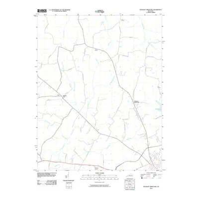
2010 Map of Pleasant Green Hill
USGS Topo · Published 2010About this map
Sinking Fork and Pleasant Green Hill anchor this rural landscape in Christian County, where the dendritic drainage patterns of the Tradewater River and its various tributaries define the local geography. The area's agricultural and social history is visible through a network of country roads named for local families, such as Dudley Boyd Rd and J Gresham Rd, connecting small settlements and isolated farmsteads. Genealogical interest is concentrated in several burial sites including Fuller Cemetery, Hamby Cemetery, and Wood Cemetery.
Find a feature on this map
46 named features on this map. Tap any name to fly to it.
Don’t see what you’re looking for? This feature index may not catch every label — zoom into the map to look around manually.
Map Details
Editions of this 2010 Pleasant Green Hill Map
This is the sole edition of this map. No revisions or reprints were ever made.
Other maps of this area

1909 · Dawson Springs
USGS Topo · 1:48,000

1911 · Dawson Springs
USGS Topo · 1:62,500

1912 · Nortonville
USGS Topo · 1:62,500

1950 · Caledonia
USGS Topo · 1:24,000

1951 · Church Hill
USGS Topo · 1:24,000

1951 · Caledonia
USGS Topo · 1:24,000

1951 · Hopkinsville
USGS Topo · 1:24,000

1952 · Pleasant Green Hill
USGS Topo · 1:24,000

1952 · Kelly
USGS Topo · 1:24,000

1952 · Crofton
USGS Topo · 1:24,000