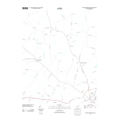
2013 Map of Pleasant Green Hill
USGS Topo · Published 2013About this map
Sinking Fork and Pleasant Green Hill anchor this rural Christian County landscape, where the karst-influenced drainage of the region is evident in the many forks and branches. The terrain is defined by the headwaters of the Muddy Fork Little River and the Tradewater River, with numerous small watercourses like Sandlick Cr and Shurdan Cr carving through the agricultural land. This area reflects a long history of family settlement, evidenced by the high density of small cemeteries such as Hamby Cem, Fuller Cem, and Harmony Grave Cem tucked away off secondary routes.
Find a feature on this map
81 named features on this map. Tap any name to fly to it.
Don’t see what you’re looking for? This feature index may not catch every label — zoom into the map to look around manually.
Map Details
Editions of this 2013 Pleasant Green Hill Map
This is the sole edition of this map. No revisions or reprints were ever made.
Other maps of this area

1909 · Dawson Springs
USGS Topo · 1:48,000

1911 · Dawson Springs
USGS Topo · 1:62,500

1912 · Nortonville
USGS Topo · 1:62,500

1950 · Caledonia
USGS Topo · 1:24,000

1951 · Church Hill
USGS Topo · 1:24,000

1951 · Caledonia
USGS Topo · 1:24,000

1951 · Hopkinsville
USGS Topo · 1:24,000

1952 · Pleasant Green Hill
USGS Topo · 1:24,000

1952 · Kelly
USGS Topo · 1:24,000

1952 · Crofton
USGS Topo · 1:24,000