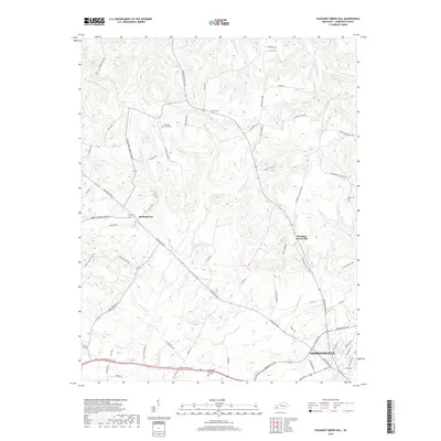
2019 Map of Pleasant Green Hill
USGS Topo · Published 2019About this map
Hopkinsville anchors the southeastern corner of this landscape, where the city's residential streets and the Hopkinsville Byp give way to the rural agriculture of Christian County. The terrain is defined by a dense network of hydrologic features, including the Muddy Fork Little River and its various tributaries such as Sandlick Cr and Shurdan Cr. This area maintains a distinctively agrarian character, with small settlements like Pleasant Green Hill and Sinking Fork serving as local hubs for the surrounding farmsteads. Genealogical researchers will find several well-documented burial grounds throughout the area, from Harmony Grove Cem in the north to the more modern Green Hill Memorial Gardens near the city edge. The road network, including historic routes like Princeton Rd and Dawson Springs Rd, reflects centuries of movement between these rural communities and the county seat.
Find a feature on this map
70 named features on this map. Tap any name to fly to it.
Don’t see what you’re looking for? This feature index may not catch every label — zoom into the map to look around manually.
Map Details
Editions of this 2019 Pleasant Green Hill Map
This is the sole edition of this map. No revisions or reprints were ever made.
Other maps of this area

1909 · Dawson Springs
USGS Topo · 1:48,000

1911 · Dawson Springs
USGS Topo · 1:62,500

1912 · Nortonville
USGS Topo · 1:62,500

1950 · Caledonia
USGS Topo · 1:24,000

1951 · Church Hill
USGS Topo · 1:24,000

1951 · Caledonia
USGS Topo · 1:24,000

1951 · Hopkinsville
USGS Topo · 1:24,000

1952 · Pleasant Green Hill
USGS Topo · 1:24,000

1952 · Kelly
USGS Topo · 1:24,000

1952 · Crofton
USGS Topo · 1:24,000