
2011 Map of Pleasant Grove
USGS Topo · Published 2011About this map
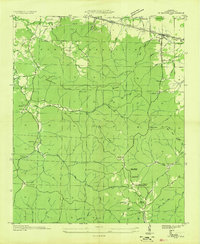
Cedar Creek Reservoir dominates this portion of Franklin County, its irregular shoreline reaching into deep hollows and creek beds. The landscape is defined by the containment of Cedar Creek behind the Cedar Creek Dam, a project that transformed the local geography. For genealogists, the map is remarkably detailed regarding burial sites, recording numerous family and community grounds such as Coondog Cemetery, Blue Lick Cemetery, and Ezzell Cemetery. Settlement patterns are visible near Pleasant Grove and White Oak, while older transit points are preserved through labels like Slickrock Ford and Ezzell Ford. Many roads, such as Coondog Cemetery Rd and Bond Cemetery Rd, lead directly to these historical landmarks, reflecting the area's deep-rooted community history prior to the reservoir's expansion.
Find a feature on this map
75 named features on this map. Tap any name to fly to it.
Don’t see what you’re looking for? This feature index may not catch every label — zoom into the map to look around manually.
Map Details
Editions of this 2011 Pleasant Grove Map
This is the sole edition of this map. No revisions or reprints were ever made.
Other maps of this area

1925 · Barton
USGS Topo · 1:62,500

1926 · Barton
USGS Topo · 1:48,000

1929 · Barton
USGS Topo · 1:62,500

1935 · Pleasant Site
USGS Topo · 1:24,000

1936 · Frankfort
USGS Topo · 1:24,000

1936 · Pleasant Grove
USGS Topo · 1:24,000

1936 · Isbell
USGS Topo · 1:24,000

1936 · Pride
USGS Topo · 1:24,000
1936 · Barton
USGS Topo · 1:24,000

1936 · Halltown
USGS Topo · 1:24,000