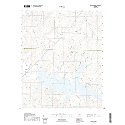
2018 Map of Pleasant Grove
USGS Topo · Published 2018About this map
Cedar Cr Reservoir dominates the southern half of this landscape on the boundary of Colbert and Franklin Counties. The expansive water body is fed by numerous tributaries, including Hollum Mill Br and Britton Br, creating a complex shoreline that defines the local geography. Small settlements and family landmarks are scattered throughout the region, such as Pleasant Grove and White Oak.
Find a feature on this map
75 named features on this map. Tap any name to fly to it.
Don’t see what you’re looking for? This feature index may not catch every label — zoom into the map to look around manually.
Map Details
Editions of this 2018 Pleasant Grove Map
This is the sole edition of this map. No revisions or reprints were ever made.
Other maps of this area

1925 · Barton
USGS Topo · 1:62,500

1926 · Barton
USGS Topo · 1:48,000

1929 · Barton
USGS Topo · 1:62,500

1935 · Pleasant Site
USGS Topo · 1:24,000

1936 · Frankfort
USGS Topo · 1:24,000

1936 · Pleasant Grove
USGS Topo · 1:24,000

1936 · Isbell
USGS Topo · 1:24,000

1936 · Pride
USGS Topo · 1:24,000
1936 · Barton
USGS Topo · 1:24,000

1936 · Halltown
USGS Topo · 1:24,000