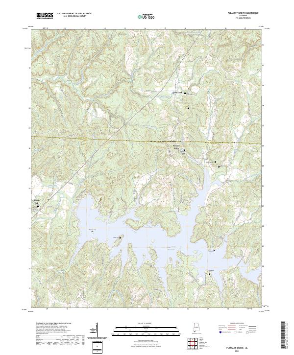
2024 Map of Pleasant Grove
USGS Topo · Published 2024About this map
Cedar Creek Reservoir dominates the southern landscape of this terrain where the Colbert and Franklin county line divides the rural countryside. The complex shoreline of the reservoir is fed by numerous tributaries including Barker Branch and Britton Branch, reflecting a landscape defined by its modern water management and dendritic drainage patterns. Genealogical interests are well-served by an unusually high density of family and community burial sites, such as Ezzell Cem, Bond Cem, and the Cedar Creek and White Oak Cem near the settlement of White Oak. The northern portion of the map is characterized by small communities like Pleasant Grove and Rock Creek, connected by a network of county roads such as Srygley Church Rd and High Chaparral Rd. Many of these routes, including Coondog Cemetery Rd, provide access to local landmarks and family-named cemeteries throughout the hills and hollows.
Find a feature on this map
73 named features on this map. Tap any name to fly to it.
Don’t see what you’re looking for? This feature index may not catch every label — zoom into the map to look around manually.
Map Details
Editions of this 2024 Pleasant Grove Map
This is the sole edition of this map. No revisions or reprints were ever made.
Other maps of this area

1925 · Barton
USGS Topo · 1:62,500

1926 · Barton
USGS Topo · 1:48,000

1929 · Barton
USGS Topo · 1:62,500

1935 · Pleasant Site
USGS Topo · 1:24,000

1936 · Frankfort
USGS Topo · 1:24,000

1936 · Pleasant Grove
USGS Topo · 1:24,000

1936 · Isbell
USGS Topo · 1:24,000

1936 · Pride
USGS Topo · 1:24,000
1936 · Barton
USGS Topo · 1:24,000

1936 · Halltown
USGS Topo · 1:24,000