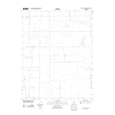
2012 Map of Pleasant Grove
USGS Topo · Published 2012About this map
The agricultural plains of the Sacramento Valley are defined by an intricate network of irrigation and drainage infrastructure, such as the South Sutter Ditch and King Slough. This 2012 survey reveals the rural character of western Placer and southern Sutter counties, where small settlements like Pleasant Grove and Sankey sit amidst a grid of section-line roads. The landscape is primarily shaped by the water management required for farming, with Pleasant Grove Cr and Curry Cr meandering through the territory.
Find a feature on this map
41 named features on this map. Tap any name to fly to it.
Don’t see what you’re looking for? This feature index may not catch every label — zoom into the map to look around manually.
Map Details
Editions of this 2012 Pleasant Grove Map
This is the sole edition of this map. No revisions or reprints were ever made.
Other maps of this area

1891 · Sacramento
USGS Topo · 1:125,000

1892 · Sacramento
USGS Topo · 1:125,000

1893 · Sacramento
USGS Topo · 1:125,000

1902 · Fairoaks
USGS Topo · 1:62,500

1907 · Davisville
USGS Topo · 1:62,500

1910 · Sheridan
USGS Topo · 1:31,680

1910 · Lincoln
USGS Topo · 1:31,680

1910 · Roseville
USGS Topo · 1:31,680

1910 · Vernon
USGS Topo · 1:31,680

1910 · Nicolaus
USGS Topo · 1:31,680