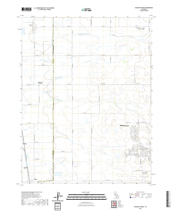
2021 Map of Pleasant Grove
USGS Topo · Published 2021About this map
The boundary between Sutter Co and Placer Co defines the layout of this section of the Sacramento Valley, where irrigation and drainage networks support extensive agricultural tracts. Significant waterways like the Auburn Ravine and King Slough cross the terrain, alongside the engineered Sutter Ditch. While much of the landscape is dominated by the rural grids of the Central Valley, the southeastern corner shows the increasing suburban density of Roseville, with residential developments such as those along Solaire Dr and Pleasant Grove Blvd expanding toward the traditional farm tracts. Historical settlements such as Pleasant Grove, Sankey, and Riego remain as small hubs within the American Basin, connected by a network of local thoroughfares like Sunset Blvd W and Base Line Rd.
Find a feature on this map
76 named features on this map. Tap any name to fly to it.
Don’t see what you’re looking for? This feature index may not catch every label — zoom into the map to look around manually.
Map Details
Editions of this 2021 Pleasant Grove Map
This is the sole edition of this map. No revisions or reprints were ever made.
Other maps of this area

1891 · Sacramento
USGS Topo · 1:125,000

1892 · Sacramento
USGS Topo · 1:125,000

1893 · Sacramento
USGS Topo · 1:125,000

1902 · Fairoaks
USGS Topo · 1:62,500

1907 · Davisville
USGS Topo · 1:62,500

1910 · Sheridan
USGS Topo · 1:31,680

1910 · Lincoln
USGS Topo · 1:31,680

1910 · Roseville
USGS Topo · 1:31,680

1910 · Vernon
USGS Topo · 1:31,680

1910 · Nicolaus
USGS Topo · 1:31,680