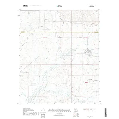
2020 Map of Pleasant Hill
USGS Topo · Published 2020About this map
Pleasant Hill serves as the focal point of this survey, situated at the junction where local parish roads and historic routes converge near the De Soto Parish and Sabine Parish line. The town's burial grounds, including the Pleasant Hill Cem and the Old Pleasant Hill Cem to the north, offer a physical record of the community’s longevity. To the southeast, the settlement of Spring Ridge sits amidst a landscape defined by an intricate network of waterways, most notably the meandering course of Bayou San Miguel and its various tributaries like San Miguel Cr. The terrain is marked by family-named routes such as Stennett Rd and Brown Heirs Rd, reflecting the generational landholdings of the region. This modern topographic study details the drainage patterns of Lost Bayou and Horsehead Cr as they cut through the timbered sections of northwestern Louisiana.
Find a feature on this map
60 named features on this map. Tap any name to fly to it.
Don’t see what you’re looking for? This feature index may not catch every label — zoom into the map to look around manually.
Map Details
Editions of this 2020 Pleasant Hill Map
This is the sole edition of this map. No revisions or reprints were ever made.
Other maps of this area

1938 · Chemard Lake
USGS Topo · 1:31,680

1938 · Hollis Creek
USGS Topo · 1:31,680

1941 · Zwolle
USGS Topo · 1:62,500

1941 · Pelican
USGS Topo · 1:62,500

1942 · Many
USGS Topo · 1:62,500

1943 · Many
USGS Topo · 1:62,500

1943 · Pleasant Hill
USGS Topo · 1:62,500

1944 · Zwolle
USGS Topo · 1:62,500

1944 · Pleasant Hill
USGS Topo · 1:62,500

1947 · Hanna
USGS Topo · 1:62,500