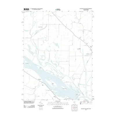
2012 Map of Pleasant Hill West
USGS Topo · Published 2012About this map
Mississippi River bottomlands dominate this landscape in western Pike County, where a complex network of secondary channels and sloughs like The Sny and Ransom Slough weave between large river islands. The era reflects a heavily managed floodplain, evidenced by the Sixmile Cr Diversion Ditch and the Sixmile Settling Basin designed to control the flow of water around the agrarian tracts. Smaller settlements and landing points such as McIntosh and Roblee are scattered near the river, while prominent landforms like Jaeger Knob rise above the flat alluvial plain.
Find a feature on this map
75 named features on this map. Tap any name to fly to it.
Don’t see what you’re looking for? This feature index may not catch every label — zoom into the map to look around manually.
Map Details
Editions of this 2012 Pleasant Hill West Map
This is the sole edition of this map. No revisions or reprints were ever made.
Other maps of this area

1890 · Louisiana
USGS Topo · 1:125,000

1926 · Pittsfield
USGS Topo · 1:62,500

1930 · Nebo
USGS Topo · 1:62,500

1931 · Barry
USGS Topo · 1:62,500

1934 · Nebo
USGS Topo · 1:48,000

1936 · Barry
USGS Topo · 1:48,000

1937 · Bowling Green
USGS Topo · 1:62,500

1940 · Bowling Green
USGS Topo · 1:62,500

1942 · Nebo
USGS Topo · 1:62,500

1944 · Barry
USGS Topo · 1:62,500