2021 Map of Pleasant Hope
USGS Topo · Published 2021About this map
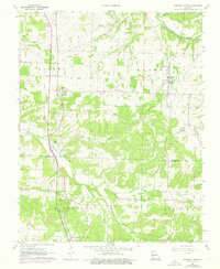
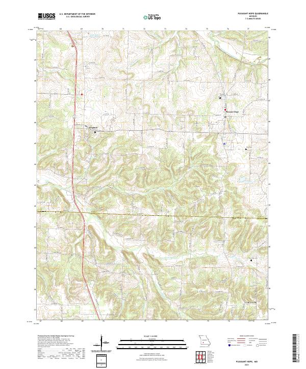
The Pleasant Hope and Brighton communities anchor this southwest Missouri landscape, straddling the northern border of Greene and Polk counties. The terrain is defined by the winding courses of the Pomme de Terre River and the N Dry Sac River, which feed into local agricultural basins. Local history is preserved in several burial grounds including Pleasant Hope Cem, Brighton Cem, New Hope Cem, and Tiller Cem, reflecting the area's long-standing rural settlement patterns. Modern infrastructure like State Hwy H and State Hwy Z connects these farmsteads to larger regional networks. Water management is a visible priority here, evidenced by the Ralph Brooks Reservoir in the northwest and Chester Jenkins Lake further east. The map captures a detailed snapshot of a Missouri prairie-and-creek landscape where the local economy remains tied to the land and its numerous tributaries such as Horse Cr and Sycamore Cr.
Find a feature on this map
103 named features on this map. Tap any name to fly to it.
Don’t see what you’re looking for? This feature index may not catch every label — zoom into the map to look around manually.
Map Details
Editions of this 2021 Pleasant Hope Map
This is the sole edition of this map. No revisions or reprints were ever made.