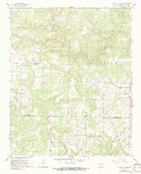
1965 Map of Pleasant Plains
USGS Topo · Published 1966About this map
Salado Creek and its many tributaries, including the colorfully named Wagon Wheel Creek, define the landscape of this Arkansas region as it appeared in the mid-1960s. The area spans the border of Independence and White counties, with the small community of Pleasant Plains serving as a focal point near the eastern edge. Settlement patterns follow the winding creek valleys and ridges, marked by numerous rural religious and social centers such as New Bethel Ch, Flippo Chapel, and the uniquely named Board Shanty Ch.
Find a feature on this map
40 named features on this map. Tap any name to fly to it.
Don’t see what you’re looking for? This feature index may not catch every label — zoom into the map to look around manually.
Map Details
Editions of this 1965 Pleasant Plains Map
2 editions found

Other maps of this area

1890 · Batesville
USGS Topo · 1:125,000

1891 · Batesville
USGS Topo · 1:125,000

1935 · Bald Knob
USGS Topo · 1:62,500

1942 · Jamestown
USGS Topo · 1:31,680

1942 · Almond
USGS Topo · 1:31,680

1942 · Salado
USGS Topo · 1:31,680

1953 · Memphis
USGS Topo · 1:250,000

1956 · Memphis
USGS Topo · 1:250,000

1962 · Pangburn
USGS Topo · 1:24,000
1965 · Salado
USGS Topo · 1:24,000