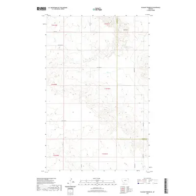
2020 Map of Pleasant Prairie NE
USGS Topo · Published 2020About this map
Eagles Nest rises above the high plains at the intersection of northeastern Montana's Sheridan and Daniels counties. This expansive prairie landscape is defined by the winding drainages of Eagle Cr and Wolf Cr, which have carved intricate coulees into the plateau. The map details a geometric grid of rural transit including Eagle Creek RD and Smoke Creek RD, reflecting the systematic settlement patterns of the Big Sky country. Far from major population centers, the area consists primarily of agricultural land and open range, where local family names and landmarks like Kurtz RD and Gilbertson RD mark the enduring presence of ranching and dryland farming operations in this isolated corner of the state.
Find a feature on this map
17 named features on this map. Tap any name to fly to it.
Don’t see what you’re looking for? This feature index may not catch every label — zoom into the map to look around manually.
Map Details
Editions of this 2020 Pleasant Prairie NE Map
This is the sole edition of this map. No revisions or reprints were ever made.
Other maps of this area

1954 · Wolf Point
USGS Topo · 1:250,000

1958 · Wolf Point
USGS Topo · 1:250,000

1973 · Flaxville
USGS Topo · 1:24,000

1973 · Navajo
USGS Topo · 1:24,000

1973 · Pleasant Prairie
USGS Topo · 1:24,000

1973 · Pleasant Prairie NW
USGS Topo · 1:24,000

1973 · Pleasant Prairie SW
USGS Topo · 1:24,000

1973 · Pleasant Prairie NE
USGS Topo · 1:24,000

1983 · Redstone
USGS Topo · 1:24,000

1983 · Soo NW
USGS Topo · 1:24,000