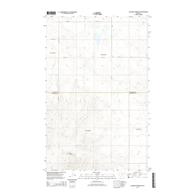
2014 Map of Pleasant Prairie SW
USGS Topo · Published 2014About this map
The boundary between Daniels and Roosevelt counties divides this section of northeastern Montana, where the topography is defined by the winding course of Give Out Morgan Cr. This high prairie landscape is characterized by a network of sectional roads and localized landforms, most notably the prominent Square Butte in the southern portion of the quadrangle. The drainage pattern of the creek and the presence of a mapped Spring indicate the vital role of water management in this agricultural region. The grid-like arrangement of thoroughfares such as Wagon Wheel Rd and Bummer Rd reflects the systematic land division of the Great Plains, providing clear routes between scattered homesteads and pastures at the edge of the Poplar District.
Find a feature on this map
14 named features on this map. Tap any name to fly to it.
Don’t see what you’re looking for? This feature index may not catch every label — zoom into the map to look around manually.
Map Details
Editions of this 2014 Pleasant Prairie SW Map
This is the sole edition of this map. No revisions or reprints were ever made.
Other maps of this area

1910 · Cuskers
USGS Topo · 1:62,500

1912 · Hay Creek
USGS Topo · 1:62,500

1915 · Cuskers
USGS Topo · 1:62,500

1954 · Wolf Point
USGS Topo · 1:250,000

1958 · Wolf Point
USGS Topo · 1:250,000

1973 · Bredette
USGS Topo · 1:24,000

1973 · Line Coulee
USGS Topo · 1:24,000

1973 · Pleasant Prairie
USGS Topo · 1:24,000

1973 · Pleasant Prairie NW
USGS Topo · 1:24,000

1973 · Pleasant Prairie SW
USGS Topo · 1:24,000