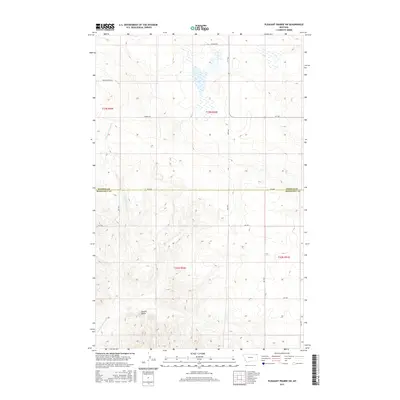
2017 Map of Pleasant Prairie SW
USGS Topo · Published 2017About this map
Square Butte stands as a prominent topographical anchor in this high-plains landscape, where the seasonal drainage of Give Out Morgan Cr carves its way through the southwestern terrain. This portion of the Poplar District is defined by its vast sections and long, straight corridors, notably along the boundary between Daniels and Roosevelt Counties. The network of rural routes, including the evocative Wagon Wheel Rd and Bummer Rd, suggests a landscape shaped by ranching and early homesteading access. Unlike more developed regions, the area maintains a strictly grid-based character, with isolated cattle trails like the R-Y Trl providing passage through the shifting contours of the prairie.
Find a feature on this map
19 named features on this map. Tap any name to fly to it.
Don’t see what you’re looking for? This feature index may not catch every label — zoom into the map to look around manually.
Map Details
Editions of this 2017 Pleasant Prairie SW Map
This is the sole edition of this map. No revisions or reprints were ever made.
Other maps of this area

1910 · Cuskers
USGS Topo · 1:62,500

1912 · Hay Creek
USGS Topo · 1:62,500

1915 · Cuskers
USGS Topo · 1:62,500

1954 · Wolf Point
USGS Topo · 1:250,000

1958 · Wolf Point
USGS Topo · 1:250,000

1973 · Bredette
USGS Topo · 1:24,000

1973 · Line Coulee
USGS Topo · 1:24,000

1973 · Pleasant Prairie
USGS Topo · 1:24,000

1973 · Pleasant Prairie NW
USGS Topo · 1:24,000

1973 · Pleasant Prairie SW
USGS Topo · 1:24,000