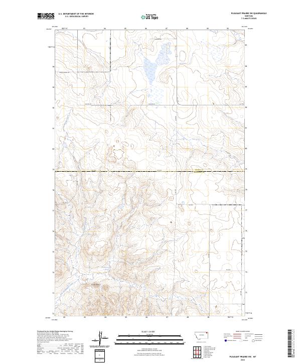
2024 Map of Pleasant Prairie SW
USGS Topo · Published 2024About this map
Square Butte rises above the transition between Daniels and Roosevelt counties, serving as a prominent landmark in this northeastern Montana landscape. The hydrology is dominated by the meandering course of Give Out Morgan Creek, which cuts through the coulees and draws that characterize the terrain. This area is defined by a sparse but functional grid of rural infrastructure, where named routes like Wagon Wheel Rd and Bummer Rd suggest the enduring importance of livestock ranching and agricultural access in the high plains. A few scattered water sources, including a named Spring, provide critical points of interest in an otherwise dry environment. The presence of the R-Y Trl and various numbered county roads like RD 2030 illustrates the late 20th and early 21st-century evolution of local transportation across the Great Plains.
Find a feature on this map
20 named features on this map. Tap any name to fly to it.
Don’t see what you’re looking for? This feature index may not catch every label — zoom into the map to look around manually.
Map Details
Editions of this 2024 Pleasant Prairie SW Map
This is the sole edition of this map. No revisions or reprints were ever made.
Other maps of this area

1910 · Cuskers
USGS Topo · 1:62,500

1912 · Hay Creek
USGS Topo · 1:62,500

1915 · Cuskers
USGS Topo · 1:62,500

1954 · Wolf Point
USGS Topo · 1:250,000

1958 · Wolf Point
USGS Topo · 1:250,000

1973 · Bredette
USGS Topo · 1:24,000

1973 · Line Coulee
USGS Topo · 1:24,000

1973 · Pleasant Prairie
USGS Topo · 1:24,000

1973 · Pleasant Prairie NW
USGS Topo · 1:24,000

1973 · Pleasant Prairie SW
USGS Topo · 1:24,000