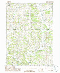
1985 Map of Pleasant Valley
USGS Topo · Published 1986About this map
The boundary between Jo Daviess Co Carroll Co divides a landscape defined by the branching tributaries of the Plum River. In the northern section, the village of Massbach sits near the headwaters of Derinda Creek, while the settlement of Pleasant Valley occupies the valley floor where the Muddy Plum River joins the main stem. This mid-1980s topography reveals an upland region characterized by deep creek drainages and agricultural plots, punctuated by small rural centers and isolated industrial sites like a Quarry near the eastern edge.
Find a feature on this map
14 named features on this map. Tap any name to fly to it.
Don’t see what you’re looking for? This feature index may not catch every label — zoom into the map to look around manually.
Map Details
Editions of this 1985 Pleasant Valley Map
This is the sole edition of this map. No revisions or reprints were ever made.
Other maps of this area

1892 · Savanna
USGS Topo · 1:62,500

1911 · Elizabeth
USGS Topo · 1:62,500

1936 · Elizabeth
USGS Topo · 1:62,500

1937 · Lena
USGS Topo · 1:48,000

1942 · Mt Carroll
USGS Topo · 1:62,500

1942 · Lena
USGS Topo · 1:62,500

1943 · Lena
USGS Topo · 1:62,500

1944 · Mt Carroll
USGS Topo · 1:62,500

1952 · Savanna
USGS Topo · 1:62,500

1953 · Blackhawk
USGS Topo · 1:24,000