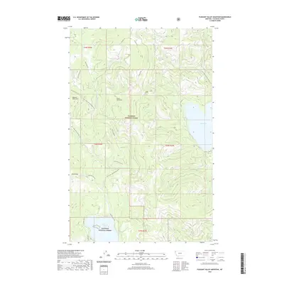
2020 Map of Pleasant Valley Mountain
USGS Topo · Published 2020About this map
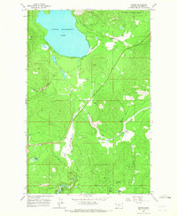
The Salish Mountains dominate this area of the Flathead National Forest, defined by a series of high divides and creek drainages that separate major water bodies. In the northeastern portion of the map, Ashley Lake sits framed by steep topography, while the northern edge of Little Bitterroot Lake appears in the south. The landscape is an active working forest, evidenced by the extensive network of service roads such as Nat For Dev Rd 5356 and Natl Forest Develop Road 5348 Rd. Significant elevations include Pleasant Valley Mtn and the transit point at Haskill Pass. Resource extraction is noted at McGovern Pit near the headwaters of McGovern Cr. The hydrologic pattern is shaped by the Ashley Divide, which directs flow into various drainages including Fish Cr and Cottonwood Cr.
Find a feature on this map
33 named features on this map. Tap any name to fly to it.
Don’t see what you’re looking for? This feature index may not catch every label — zoom into the map to look around manually.
Map Details
Editions of this 2020 Pleasant Valley Mountain Map
This is the sole edition of this map. No revisions or reprints were ever made.
Other maps of this area

1957 · Kalispell
USGS Topo · 1:250,000

1960 · Kalispell
USGS Topo · 1:250,000

1961 · Kalispell
USGS Topo · 1:250,000

1962 · Lost Creek Divide
USGS Topo · 1:24,000

1962 · Ashley Mountain
USGS Topo · 1:24,000

1963 · Sylvia Lake
USGS Topo · 1:24,000
1964 · Lone Lake
USGS Topo · 1:24,000
1964 · Haskill Mountain
USGS Topo · 1:24,000
1964 · Pleasant Valley Mountain
USGS Topo · 1:24,000
1964 · Marion
USGS Topo · 1:24,000