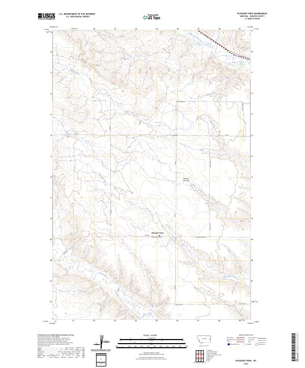
2024 Map of Pleasant View
USGS Topo · Published 2024About this map
Pleasant View sits at the heart of this Montana landscape, surrounded by the distinctive topography of Pleasant View Flat. The area is defined by a dense network of drainage systems, with Whoopup Creek and Clear Creek winding through the southern sections, while Sand Creek and Upper Sevenmile Creek carve through the north. This 2024 survey reflects the modern agricultural and rural layout of Dawson County, showing how historical property lines and township boundaries like t15n r54e have shaped the placement of local thoroughfares.
Find a feature on this map
22 named features on this map. Tap any name to fly to it.
Don’t see what you’re looking for? This feature index may not catch every label — zoom into the map to look around manually.
Map Details
Editions of this 2024 Pleasant View Map
This is the sole edition of this map. No revisions or reprints were ever made.
Other maps of this area

1909 · Glendive
USGS Topo · 1:250,000

1953 · Miles City
USGS Topo · 1:250,000

1954 · Glendive
USGS Topo · 1:250,000

1957 · Miles City
USGS Topo · 1:250,000

1957 · Glendive
USGS Topo · 1:250,000

1958 · Miles City
USGS Topo · 1:250,000

1958 · Glendive
USGS Topo · 1:250,000

1967 · Marsh
USGS Topo · 1:24,000

1967 · Hoyt
USGS Topo · 1:24,000
1967 · Forest Park
USGS Topo · 1:24,000