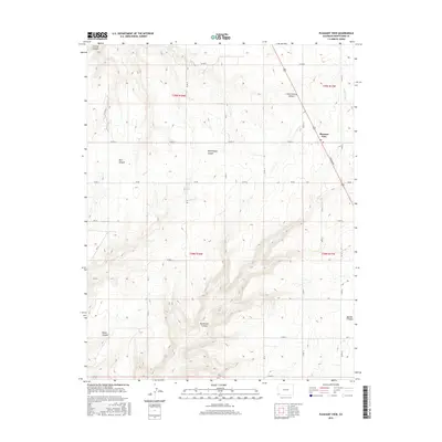
2016 Map of Pleasant View
USGS Topo · Published 2016About this map
Pleasant View serves as the primary settlement on this high plateau, where the local economy is tied to the managed water systems and the surrounding agricultural grid. The landscape is defined by a series of deep drainage features that cut through the terrain, including Hovenweep Canyon, Ruin Canyon, and Little Cahone Canyon. These natural deep-cut landmarks are interspersed with man-made infrastructure like the Dove Cr Canal and S Canal, which are vital for supporting life in this arid part of the state. The road network follows a strict rectilinear pattern, primarily utilizing county designations like Co RD Ee and Co RD 16, while N Broadway provides a central corridor through the community. The juxtaposition of modern irrigation canals against the ancient-sounding canyon names highlights the long-standing importance of water management in this high-desert environment.
Find a feature on this map
37 named features on this map. Tap any name to fly to it.
Don’t see what you’re looking for? This feature index may not catch every label — zoom into the map to look around manually.
Map Details
Editions of this 2016 Pleasant View Map
This is the sole edition of this map. No revisions or reprints were ever made.
Other maps of this area

1956 · Cortez
USGS Topo · 1:250,000

1957 · Moqui NW
USGS Topo · 1:24,000

1957 · Cedar 3 NW
USGS Topo · 1:24,000

1957 · Cedar 3 SW
USGS Topo · 1:24,000

1958 · Cortez
USGS Topo · 1:250,000

1959 · Cortez
USGS Topo · 1:250,000

1962 · Cortez
USGS Topo · 1:250,000

1965 · Cahone
USGS Topo · 1:24,000

1965 · Woods Canyon
USGS Topo · 1:24,000

1965 · Yellow Jacket
USGS Topo · 1:24,000