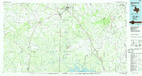
1985 Map of Pleasanton
USGS Topo · Published 1985About this map
Pleasanton and Jourdanton serve as the primary anchors of this South Texas landscape, where the Atascosa River and its numerous tributaries like La Parita Creek and Lagunillas Creek define the drainage patterns. The northern half of the sheet is marked by the Big Foot area and the Oil Field, indicating the importance of petroleum extraction to the local economy during the mid-1980s. Transportation is dominated by the Missouri Pacific railroad line, which connects the smaller rail-side settlements of Campbellton and Whitsett as it follows the river valley toward the coast.
Find a feature on this map
131 named features on this map. Tap any name to fly to it.
Don’t see what you’re looking for? This feature index may not catch every label — zoom into the map to look around manually.
Map Details
Editions of this 1985 Pleasanton Map
2 editions found
Other maps of this area

1920 · Smiley
USGS Topo · 1:125,000

1920 · Mikeska
USGS Topo · 1:125,000

1925 · Simmons No. 1
USGS Topo · 1:48,000

1925 · Tilden No. 1
USGS Topo · 1:48,000

1925 · Crowther No. 3
USGS Topo · 1:48,000

1925 · Tordia No. 1
USGS Topo · 1:48,000

1925 · Simmons No. 2
USGS Topo · 1:48,000

1927 · Pearsall
USGS Topo · 1:62,500

1927 · Oakville
USGS Topo · 1:62,500

1929 · Cotulla
USGS Topo · 1:125,000