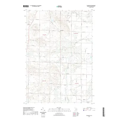
2019 Map of Pleasanton
USGS Topo · Published 2019About this map
The settlement of Kaleva anchors the southern portion of this Manistee County landscape, where the grid of rural roads meets a complex network of wetlands and watercourses. The terrain is defined by the winding path of Bear Creek and its many tributaries, including Little Bear Cr, Halls Cr, and Beaver Cr. This area preserves several localized landmarks, such as Bonds Bridge and Jopp Bridge, which provide key crossings over the creek systems. For those researching family history, the map identifies the Pleasanton Township Cem and Springdale Cem, situated near the crossroads of Humphrey. The presence of Old Grade Rd suggests the path of former transit or logging lines, while numerous small water bodies like Glovers Lake, Mud Lake, and the distinctly named Mäkinen Pond dot the glacial topography.
Find a feature on this map
46 named features on this map. Tap any name to fly to it.
Don’t see what you’re looking for? This feature index may not catch every label — zoom into the map to look around manually.
Map Details
Editions of this 2019 Pleasanton Map
This is the sole edition of this map. No revisions or reprints were ever made.
Other maps of this area

1954 · Traverse City
USGS Topo · 1:250,000

1954 · Manitowoc
USGS Topo · 1:250,000

1956 · Onekama
USGS Topo · 1:62,500

1956 · Thompsonville
USGS Topo · 1:62,500

1956 · Frankfort
USGS Topo · 1:62,500

1957 · Copemish
USGS Topo · 1:62,500

1958 · Traverse City
USGS Topo · 1:250,000

1958 · Manitowoc
USGS Topo · 1:250,000

1976 · Frankfort SE
USGS Topo · 1:24,000

1976 · Onekama SE
USGS Topo · 1:24,000