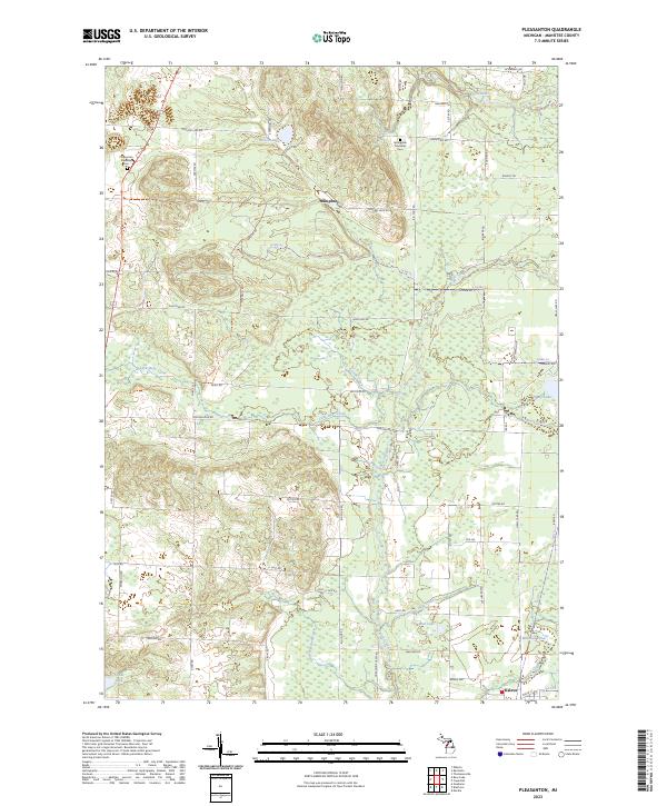
2023 Map of Pleasanton
USGS Topo · Published 2023About this map
The settlement of Kaleva anchors the southeastern corner of this landscape in rural Manistee County, where a dense network of local roads and sections meets the natural drainages of the Betsie River and Bear Creek. The terrain is defined by a series of glacial lakes and small water bodies, including Glovers Lake and Healy Lake, which likely influenced the early agricultural and timber development of the region. Local history and genealogy are preserved at the Pleasanton Township Cem and Springdale Township Cem, serving as physical markers for the area's rural communities. Significant water features like Little Bear Creek and Greene Creek wind through the township boundaries, illustrating the hydrologic character of this part of Northern Michigan. The inclusion of the Lp386 Trl and various township roads reflects the modern infrastructure laid over the historical public land survey system.
Find a feature on this map
69 named features on this map. Tap any name to fly to it.
Don’t see what you’re looking for? This feature index may not catch every label — zoom into the map to look around manually.
Map Details
Editions of this 2023 Pleasanton Map
This is the sole edition of this map. No revisions or reprints were ever made.
Other maps of this area

1954 · Traverse City
USGS Topo · 1:250,000

1954 · Manitowoc
USGS Topo · 1:250,000

1956 · Onekama
USGS Topo · 1:62,500

1956 · Thompsonville
USGS Topo · 1:62,500

1956 · Frankfort
USGS Topo · 1:62,500

1957 · Copemish
USGS Topo · 1:62,500

1958 · Traverse City
USGS Topo · 1:250,000

1958 · Manitowoc
USGS Topo · 1:250,000

1976 · Frankfort SE
USGS Topo · 1:24,000

1976 · Onekama SE
USGS Topo · 1:24,000