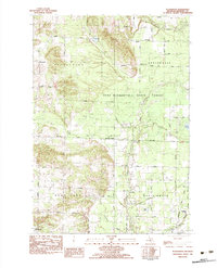
1982 Map of Pleasanton
USGS Topo · Published 1983About this map
The Chesapeake and Ohio railroad corridor anchors the southern edge of this West Michigan landscape, passing through the village of Kaleva. The terrain is defined by a dense network of namesake rural roads and water bodies, including Glovers Lake and the Betsie River winding through the north. Large tracts are preserved as the Pere Marquette State Forest, reflecting the region's managed timber and recreational heritage. Smaller settlements like Pleasanton, Humphrey, and Hale Corners mark historical crossroads, often anchored by community landmarks such as the Township Cem and the Springdale Ch. This survey also documents the industrial presence of the Gas Field and localized Sand & Gravel extraction, illustrating how natural resource development integrated with traditional farming and forest lands during the early 1980s.
Find a feature on this map
51 named features on this map. Tap any name to fly to it.
Don’t see what you’re looking for? This feature index may not catch every label — zoom into the map to look around manually.
Map Details
Editions of this 1982 Pleasanton Map
2 editions found
Other maps of this area

1954 · Traverse City
USGS Topo · 1:250,000

1954 · Manitowoc
USGS Topo · 1:250,000

1956 · Onekama
USGS Topo · 1:62,500

1956 · Thompsonville
USGS Topo · 1:62,500

1956 · Frankfort
USGS Topo · 1:62,500

1957 · Copemish
USGS Topo · 1:62,500

1958 · Traverse City
USGS Topo · 1:250,000

1958 · Manitowoc
USGS Topo · 1:250,000

1976 · Frankfort SE
USGS Topo · 1:24,000

1976 · Onekama SE
USGS Topo · 1:24,000