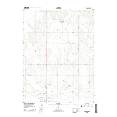
2014 Map of Pleasanton SE
USGS Topo · Published 2014About this map
Glenwood Park anchors the southern edge of this Buffalo County landscape, where the meandering course of the Wood River flows through a network of rural section roads. The map captures a moment of transition between established farming communities and modern infrastructure, notably along the Ne-10 corridor. In the northern reaches, the small settlement of Prairie Center remains a focal point for the surrounding area, marked by local landmarks like Saint Mary Cem and Prairie Center Cem.
Find a feature on this map
51 named features on this map. Tap any name to fly to it.
Don’t see what you’re looking for? This feature index may not catch every label — zoom into the map to look around manually.
Map Details
Editions of this 2014 Pleasanton SE Map
This is the sole edition of this map. No revisions or reprints were ever made.
Other maps of this area

1894 · Kearney
USGS Topo · 1:62,500

1894 · Minden
USGS Topo · 1:62,500

1896 · Kearney
USGS Topo · 1:125,000

1896 · Wood River
USGS Topo · 1:125,000

1955 · Grand Island
USGS Topo · 1:250,000

1957 · Grand Island
USGS Topo · 1:250,000

1958 · Grand Island
USGS Topo · 1:250,000

1962 · Newark
USGS Topo · 1:24,000

1962 · Riverdale
USGS Topo · 1:24,000
1962 · Pleasanton NW
USGS Topo · 1:24,000