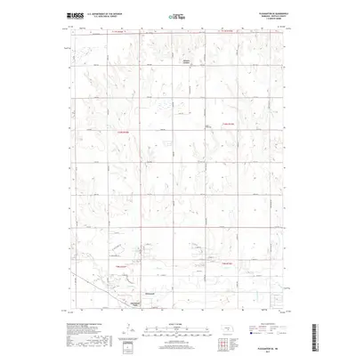
2017 Map of Pleasanton SE
USGS Topo · Published 2017About this map
The Wood River drainage defines the southern reaches of this Buffalo County landscape, where the settlement of Glenwood and the adjacent Glenwood Park sit along the riverbanks. To the north, the terrain transitions into a more dissected upland plain, marked by a series of north-south running seasonal drainages including Dry Cr and Sand Cr. This section of central Nebraska is organized by a strict section-line road network with local thoroughfares such as Homestead Rd and Pole Line Rd connecting dispersed agricultural homesteads.
Find a feature on this map
50 named features on this map. Tap any name to fly to it.
Don’t see what you’re looking for? This feature index may not catch every label — zoom into the map to look around manually.
Map Details
Editions of this 2017 Pleasanton SE Map
This is the sole edition of this map. No revisions or reprints were ever made.
Other maps of this area

1894 · Kearney
USGS Topo · 1:62,500

1894 · Minden
USGS Topo · 1:62,500

1896 · Kearney
USGS Topo · 1:125,000

1896 · Wood River
USGS Topo · 1:125,000

1955 · Grand Island
USGS Topo · 1:250,000

1957 · Grand Island
USGS Topo · 1:250,000

1958 · Grand Island
USGS Topo · 1:250,000

1962 · Newark
USGS Topo · 1:24,000

1962 · Riverdale
USGS Topo · 1:24,000
1962 · Pleasanton NW
USGS Topo · 1:24,000