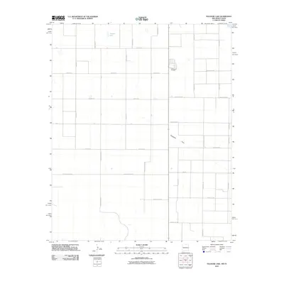
2010 Map of Pleasure Lake
USGS Topo · Published 2010About this map
The high plains of Curry County are defined by a strict geometric grid of section-line roads and the subtle drainage of Blackwater Draw. In this 2010 survey, the landscape is almost entirely partitioned for agriculture, with only a few natural depressions such as Pleasure Lake breaking the rectilinear pattern. Genealogists and local historians will find the Old Farwell Cemetery situated near the intersection of County Rd 6 and CR B, a quiet landmark on the eastern edge of the quadrangle. The map captures a moment of modern rural infrastructure, where named thoroughfares like N Roosevelt Road 2 and County Road DD provide the primary framework for movement across this level terrain. The lack of concentrated settlements highlights the isolated nature of the farmsteads that dot these plains.
Find a feature on this map
31 named features on this map. Tap any name to fly to it.
Don’t see what you’re looking for? This feature index may not catch every label — zoom into the map to look around manually.
Map Details
Editions of this 2010 Pleasure Lake Map
This is the sole edition of this map. No revisions or reprints were ever made.
Other maps of this area

1954 · Clovis
USGS Topo · 1:250,000

1957 · Clovis
USGS Topo · 1:62,500

1957 · Arch
USGS Topo · 1:62,500

1958 · Clovis
USGS Topo · 1:250,000

1962 · Birdwell Ranch
USGS Topo · 1:24,000

1963 · Lariat
USGS Topo · 1:24,000

1963 · Oklahoma Lane
USGS Topo · 1:24,000

1985 · Midway
USGS Topo · 1:24,000

1985 · Pleasure Lake
USGS Topo · 1:24,000

1985 · Muleshoe
USGS Topo · 1:100,000