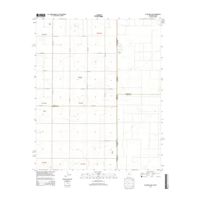
2013 Map of Pleasure Lake
USGS Topo · Published 2013About this map
Pleasure Lake sits at the heart of this high plains borderland, where the straight lines of the New Mexico-Texas state line and various county boundaries define the landscape. This 2013 survey of the Llano Estacado region illustrates a territory shaped by modern agricultural industry and precise grid-system surveying. The presence of specialized operations like Mid-Frisian Dairy, Hide-A-Way Dairy, and Desert Star Dairy reflects the area's shift toward large-scale dairy production. Natural topography is subtle here, with the shallow depression of Blackwater Draw and small ephemeral water bodies providing the only break in the geometric road network, which includes Curry Road 7 and N Roosevelt Road 1. The map also preserves local history at the Old Farwell Cem, located right along the state boundary.
Find a feature on this map
24 named features on this map. Tap any name to fly to it.
Don’t see what you’re looking for? This feature index may not catch every label — zoom into the map to look around manually.
Map Details
Editions of this 2013 Pleasure Lake Map
This is the sole edition of this map. No revisions or reprints were ever made.
Other maps of this area

1954 · Clovis
USGS Topo · 1:250,000

1957 · Clovis
USGS Topo · 1:62,500

1957 · Arch
USGS Topo · 1:62,500

1958 · Clovis
USGS Topo · 1:250,000

1962 · Birdwell Ranch
USGS Topo · 1:24,000

1963 · Lariat
USGS Topo · 1:24,000

1963 · Oklahoma Lane
USGS Topo · 1:24,000

1985 · Midway
USGS Topo · 1:24,000

1985 · Pleasure Lake
USGS Topo · 1:24,000

1985 · Muleshoe
USGS Topo · 1:100,000