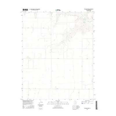
2016 Map of Pleasure Pond
USGS Topo · Published 2016About this map
Coldwater Cattle Company Lake and the adjacent Pleasure Pond define the upper northeast corner of this Sherman County landscape, where the terrain breaks into the drainage of Coldwater Cr. This high plains region is primarily organized by a rigid grid of ranch and farm roads, including FM 119 and FM 1573, which provide the primary north-south and east-west transit through the territory. The map illustrates a largely rural, agricultural environment characterized by expansive open spaces and intermittent seasonal water features typical of the Texas Panhandle. Local connectivity is maintained by a network of numbered county routes like Co RD 24 and Co RD W, which link the various land holdings and cattle operations that have historically shaped the regional economy.
Find a feature on this map
10 named features on this map. Tap any name to fly to it.
Don’t see what you’re looking for? This feature index may not catch every label — zoom into the map to look around manually.
Map Details
Editions of this 2016 Pleasure Pond Map
This is the sole edition of this map. No revisions or reprints were ever made.
Other maps of this area

1954 · Perryton
USGS Topo · 1:250,000

1958 · Perryton
USGS Topo · 1:250,000

1963 · Cactus East
USGS Topo · 1:24,000

1964 · Stevens SW
USGS Topo · 1:24,000

1965 · Spurlock Chapel
USGS Topo · 1:24,000

1972 · Capps Switch
USGS Topo · 1:24,000

1972 · Sunray
USGS Topo · 1:24,000

1974 · Stevens SE
USGS Topo · 1:24,000

1974 · Sunray 1 SW
USGS Topo · 1:24,000

1974 · Capps Switch NW
USGS Topo · 1:24,000