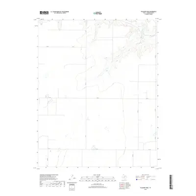
2019 Map of Pleasure Pond
USGS Topo · Published 2019About this map
Coldwater Cr carves a deep, dendritic drainage system across the northern portion of this Sherman County landscape, providing a stark contrast to the surrounding high plains. This 2019 survey captures a region defined by its vast agricultural utility and a rigid, grid-based transportation network. The intersection of Fm 119 and Fm 1573 serves as a primary local corridor, while numerous county roads like Co Rd T, Co Rd W, and Co Rd 18 demarcate the section lines. The map reveals the modern High Plains landscape where traditional livestock and grain operations are supported by a web of rural infrastructure, from the winding path of the creek to the straight-line routes of Co Rd 24 and Co Rd 23.
Find a feature on this map
8 named features on this map. Tap any name to fly to it.
Don’t see what you’re looking for? This feature index may not catch every label — zoom into the map to look around manually.
Map Details
Editions of this 2019 Pleasure Pond Map
This is the sole edition of this map. No revisions or reprints were ever made.
Other maps of this area

1954 · Perryton
USGS Topo · 1:250,000

1958 · Perryton
USGS Topo · 1:250,000

1963 · Cactus East
USGS Topo · 1:24,000

1964 · Stevens SW
USGS Topo · 1:24,000

1965 · Spurlock Chapel
USGS Topo · 1:24,000

1972 · Capps Switch
USGS Topo · 1:24,000

1972 · Sunray
USGS Topo · 1:24,000

1974 · Stevens SE
USGS Topo · 1:24,000

1974 · Sunray 1 SW
USGS Topo · 1:24,000

1974 · Capps Switch NW
USGS Topo · 1:24,000