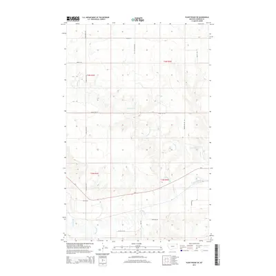
2014 Map of Plentywood SW
USGS Topo · Published 2014About this map
Big Muddy Cr snakes through this corner of Sheridan County, Montana, carving a distinct valley through the northern High Plains landscape. The area is defined by a grid of rural routes that speak to the region's agricultural and ranching layout, including named thoroughfares like Chalk Butte Rd and Hendrickson Hill Rd. These roads provide access to the undulating terrain where smaller tributaries such as Plentywood Cr, McCoy Cr, and Ford Cr feed into the larger creek system.
Find a feature on this map
20 named features on this map. Tap any name to fly to it.
Don’t see what you’re looking for? This feature index may not catch every label — zoom into the map to look around manually.
Map Details
Editions of this 2014 Plentywood SW Map
This is the sole edition of this map. No revisions or reprints were ever made.
Other maps of this area

1950 · Shippe Canyon
USGS Topo · 1:24,000

1954 · Wolf Point
USGS Topo · 1:250,000

1958 · Wolf Point
USGS Topo · 1:250,000

1983 · Plentywood NW
USGS Topo · 1:24,000

1983 · Outlook
USGS Topo · 1:24,000

1983 · Kisler Butte
USGS Topo · 1:24,000

1983 · Archer
USGS Topo · 1:24,000

1983 · Plentywood
USGS Topo · 1:24,000

1983 · Raymond
USGS Topo · 1:24,000
1983 · Soo NE
USGS Topo · 1:24,000