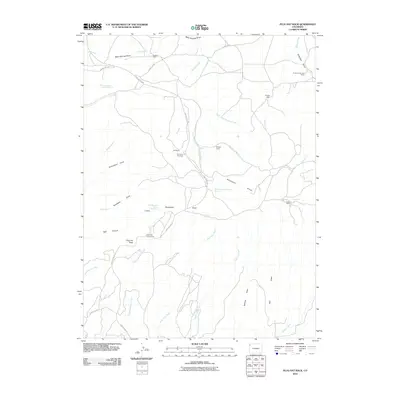
2010 Map of Plug Hat Rock
USGS Topo · Published 2010About this map
Haslem Cabin and several other remote outposts like Morgan Cabin and Fletcher Cabin are scattered across this high-desert plateau in Moffat County. The landscape is defined by a complex drainage system including Basin Springs Draw, Buckwater Draw, and Richardson Draw, which cut through the arid terrain. The presence of multiple named cabins and Antelope Springs Camp suggests a history of seasonal ranching or resource management in this isolated portion of Colorado. High points such as K Point and Plug Hat Rock provide vantage points over the surrounding canyonlands, while Escalante Overlook offers views of the intricate network of washes and creeks, such as Cliff Creek and Dripping Rock Creek, that eventually feed into the larger regional basins.
Find a feature on this map
39 named features on this map. Tap any name to fly to it.
Don’t see what you’re looking for? This feature index may not catch every label — zoom into the map to look around manually.
Map Details
Editions of this 2010 Plug Hat Rock Map
This is the sole edition of this map. No revisions or reprints were ever made.
Other maps of this area

1885 · Ashley
USGS Topo · 1:250,000

1907 · Rangely
USGS Topo · 1:125,000

1907 · Jensen
USGS Topo · 1:125,000

1910 · Jensen
USGS Topo · 1:125,000

1910 · Rangely
USGS Topo · 1:125,000

1954 · Hells Canyon
USGS Topo · 1:24,000

1954 · Vernal
USGS Topo · 1:250,000

1955 · Stuntz Reservoir
USGS Topo · 1:24,000

1958 · Vernal
USGS Topo · 1:250,000

1960 · Vernal
USGS Topo · 1:250,000