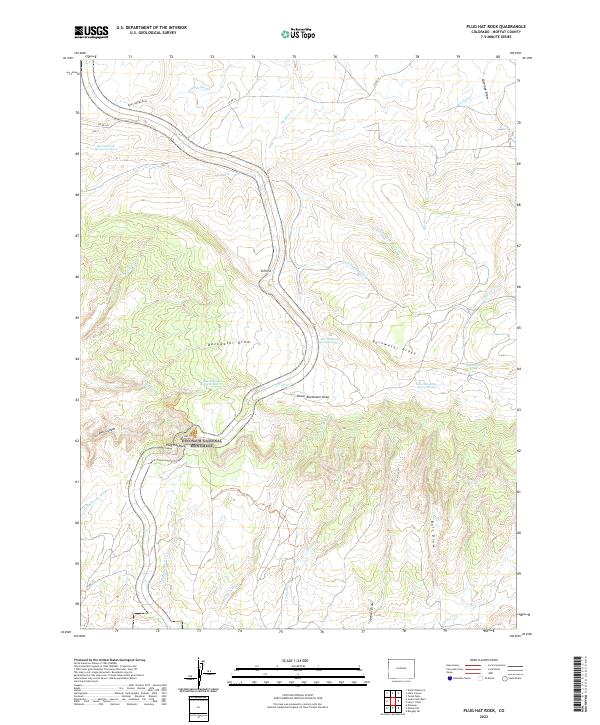
2022 Map of Plug Hat Rock
USGS Topo · Published 2022About this map
Dinosaur National Monument defines the southern portion of this landscape, where the plateau drops toward Bull Canyon and Sand Spring Wash. The terrain is characterized by a series of high ridges and deep drainages, including the prominent Buckwater Ridge and Buckwater Draw. Several vital water sources are documented across this arid region, such as Bearwater Spring and a series of numbered outlets like Blue Mountain Spring Number 2.
Find a feature on this map
39 named features on this map. Tap any name to fly to it.
Don’t see what you’re looking for? This feature index may not catch every label — zoom into the map to look around manually.
Map Details
Editions of this 2022 Plug Hat Rock Map
This is the sole edition of this map. No revisions or reprints were ever made.
Other maps of this area

1885 · Ashley
USGS Topo · 1:250,000

1907 · Rangely
USGS Topo · 1:125,000

1907 · Jensen
USGS Topo · 1:125,000

1910 · Jensen
USGS Topo · 1:125,000

1910 · Rangely
USGS Topo · 1:125,000

1954 · Hells Canyon
USGS Topo · 1:24,000

1954 · Vernal
USGS Topo · 1:250,000

1955 · Stuntz Reservoir
USGS Topo · 1:24,000

1958 · Vernal
USGS Topo · 1:250,000

1960 · Vernal
USGS Topo · 1:250,000