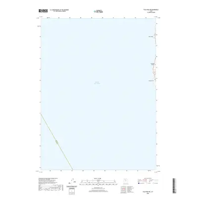
2020 Map of Plug Peak NE
USGS Topo · Published 2020About this map
The expansive waters of the Great Salt Lake dominate this 2020 topographic survey, reflecting the quiet character of this maritime desert landscape. The map is defined by the sharp transition from the open lake to the rocky eastern shore, where several prominent landmarks rise above the waterline. Elevation data reveals the rugged topography of Black Bluff, Red Rocks Canyon, and Cambria Point, which serve as the primary navigational and geological markers on this portion of the coastline. This sheet also captures a distinct administrative boundary cutting through the southwestern waters, marking the line between Davis County and Tooele County. The minimal development shown suggests a landscape primarily shaped by natural forces and fluctuating water levels rather than human infrastructure.
Find a feature on this map
5 named features on this map. Tap any name to fly to it.
Don’t see what you’re looking for? This feature index may not catch every label — zoom into the map to look around manually.
Map Details
Editions of this 2020 Plug Peak NE Map
This is the sole edition of this map. No revisions or reprints were ever made.
Other maps of this area

1885 · Tooele Valley
USGS Topo · 1:250,000

1952 · Antelope Island South
USGS Topo · 1:24,000

1953 · Tooele
USGS Topo · 1:250,000

1954 · Antelope Island
USGS Topo · 1:24,000

1954 · Antelope Island North
USGS Topo · 1:24,000

1954 · Brigham City
USGS Topo · 1:250,000

1955 · Tooele
USGS Topo · 1:250,000

1958 · Brigham City
USGS Topo · 1:250,000

1962 · Brigham City
USGS Topo · 1:250,000

1968 · Plug Peak SE
USGS Topo · 1:24,000