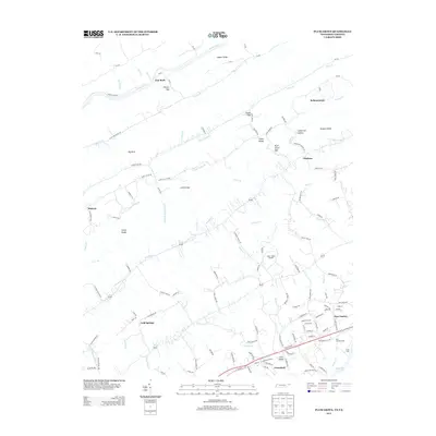
2013 Map of Plum Grove
USGS Topo · Published 2013About this map
Copper Ridge and the Clinch River define the northern reaches of this landscape, where the terrain transitions through a series of gaps and hollows into the Tennessee Valley. Small settlements and rural crossroads like New Canton, Cold Springs, and Bellamytown are connected by a network of valley roads that follow the natural contours of the land. In the southern portion of the map, the influence of modern infrastructure is evident near Greenland and the New Canton Siding, where the land meets the backwaters of Cherokee Lake.
Find a feature on this map
134 named features on this map. Tap any name to fly to it.
Don’t see what you’re looking for? This feature index may not catch every label — zoom into the map to look around manually.
Map Details
Editions of this 2013 Plum Grove Map
This is the sole edition of this map. No revisions or reprints were ever made.
Other maps of this area

1892 · Greeneville
USGS Topo · 1:125,000

1894 · Estillville
USGS Topo · 1:125,000

1896 · Greeneville
USGS Topo · 1:125,000

1904 · Greeneville
USGS Topo · 1:125,000

1935 · Surgoinsville
USGS Topo · 1:48,000

1935 · Lovelace
USGS Topo · 1:24,000

1935 · Moggasin
USGS Topo · 1:48,000

1935 · Looneys Gap
USGS Topo · 1:24,000

1935 · Clinchport
USGS Topo · 1:24,000
1935 · Duffield
USGS Topo · 1:24,000