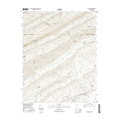
2016 Map of Plum Grove
USGS Topo · Published 2016About this map
The Clinch Mountain ridgeline dominates this corner of East Tennessee, forming a prominent natural barrier between the Poor Valley and Stanley Valley. Along the southern edge of the survey, the developed corridor of Church Hill and Surgoinsville sits near the headwaters of Cherokee Lake, where the landscape transitions from steep mountain gaps to the broader floodplains of the Clinch River. Family history is anchored in several small settlements and hollows, including Bellamytown, Okolona, and California Hollow.
Find a feature on this map
133 named features on this map. Tap any name to fly to it.
Don’t see what you’re looking for? This feature index may not catch every label — zoom into the map to look around manually.
Map Details
Editions of this 2016 Plum Grove Map
This is the sole edition of this map. No revisions or reprints were ever made.
Other maps of this area

1892 · Greeneville
USGS Topo · 1:125,000

1894 · Estillville
USGS Topo · 1:125,000

1896 · Greeneville
USGS Topo · 1:125,000

1904 · Greeneville
USGS Topo · 1:125,000

1935 · Surgoinsville
USGS Topo · 1:48,000

1935 · Lovelace
USGS Topo · 1:24,000

1935 · Moggasin
USGS Topo · 1:48,000

1935 · Looneys Gap
USGS Topo · 1:24,000

1935 · Clinchport
USGS Topo · 1:24,000
1935 · Duffield
USGS Topo · 1:24,000