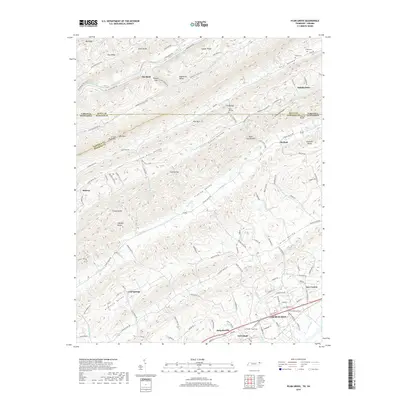
2019 Map of Plum Grove
USGS Topo · Published 2019About this map
Church Hill and Surgoinsville anchor the southern industrial corridor of this landscape along the Norfolk Southern rail line and Carters Valley Rd. North of these towns, the terrain transitions into a series of parallel ridges and valleys characteristic of the Appalachian landscape, including Clinch Mountain, Pine Mtn, and Copper Ridge. The Clinch River cuts through the northern section, bordering small rural clusters like Flat Rock and Robinette Valley.
Find a feature on this map
136 named features on this map. Tap any name to fly to it.
Don’t see what you’re looking for? This feature index may not catch every label — zoom into the map to look around manually.
Map Details
Editions of this 2019 Plum Grove Map
This is the sole edition of this map. No revisions or reprints were ever made.
Other maps of this area

1892 · Greeneville
USGS Topo · 1:125,000

1894 · Estillville
USGS Topo · 1:125,000

1896 · Greeneville
USGS Topo · 1:125,000

1904 · Greeneville
USGS Topo · 1:125,000

1935 · Surgoinsville
USGS Topo · 1:48,000

1935 · Lovelace
USGS Topo · 1:24,000

1935 · Moggasin
USGS Topo · 1:48,000

1935 · Looneys Gap
USGS Topo · 1:24,000

1935 · Clinchport
USGS Topo · 1:24,000
1935 · Duffield
USGS Topo · 1:24,000