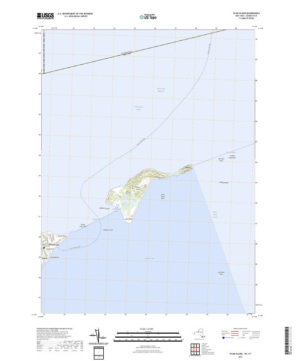
2023 Map of Plum Island
USGS Topo · Published 2023About this map
Plum Island sits as a central maritime landmark within this survey, flanked by the turbulent waters of Plum Gut and the open expanses of Long Island Sound and Gardiners Bay. The map details the delicate coastal geography of the North Fork's eastern tip, where Orient Point serves as a vital transportation hub. The presence of the Cross Sound Ferry route and the Intracostal Waterway highlights the area's ongoing importance to regional navigation. On land, the small settlement of Orient is depicted alongside local landmarks such as Latham Cem and the protected sands of Orient Beach. Underwater hazards and topographical features like Old Silas Rock, Middle Shoal Rock, and Bedford Reef illustrate the complex seafloor that has long challenged mariners navigating The Sluiceway and Block Island Sound.
Find a feature on this map
31 named features on this map. Tap any name to fly to it.
Don’t see what you’re looking for? This feature index may not catch every label — zoom into the map to look around manually.
Map Details
Editions of this 2023 Plum Island Map
This is the sole edition of this map. No revisions or reprints were ever made.
Other maps of this area

1892 · New London
USGS Topo · 1:62,500

1893 · New London
USGS Topo · 1:62,500

1893 · Saybrook
USGS Topo · 1:62,500

1903 · Gardiners Island
USGS Topo · 1:62,500

1904 · Shelter Island
USGS Topo · 1:62,500

1904 · Gardiners Island
USGS Topo · 1:62,500

1921 · Gardiners Island
USGS Topo · 1:62,500

1921 · New London
USGS Topo · 1:62,500

1934 · Niantic
USGS Topo · 1:24,000

1938 · New London
USGS Topo · 1:31,680
Featured Places
- East Hampton, NY
- Southold, NY
- Orient, Southold
- Suffolk County, NY
- Southeastern Connecticut Planning Region, CT