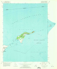
1954 Map of Plum Island
USGS Topo · Published 1971About this map
Plum Island Restricted occupies the center of this maritime survey, a location notably marked as the site of the U S Dept of Agriculture (Restricted) Dangerous Animal Diseases research facility. This mid-century coastal mapping captures the strategic and scientific isolation of the islands at the junction of Long Island Sound and Block Island Sound. To the southwest, the tip of the North Fork is anchored by Orient Point and the Orient Beach State Park, while a Ferry route connects the mainland across the turbulent waters of Plum Gut. The map records essential navigational aids like the Plum Island Lighthouse and Orient Pt Lighthouse, alongside several outlying hazards including Great Gull Island and Little Gull I. On the mainland, the Latham Cem provides a point of genealogical interest for local families.
Find a feature on this map
29 named features on this map. Tap any name to fly to it.
Don’t see what you’re looking for? This feature index may not catch every label — zoom into the map to look around manually.
Map Details
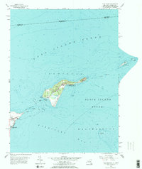
Editions of this 1954 Plum Island Map
2 editions found
Other maps of this area

1892 · New London
USGS Topo · 1:62,500

1893 · New London
USGS Topo · 1:62,500

1893 · Saybrook
USGS Topo · 1:62,500

1903 · Gardiners Island
USGS Topo · 1:62,500

1904 · Shelter Island
USGS Topo · 1:62,500

1904 · Gardiners Island
USGS Topo · 1:62,500

1921 · Gardiners Island
USGS Topo · 1:62,500

1921 · New London
USGS Topo · 1:62,500

1934 · Niantic
USGS Topo · 1:24,000

1938 · New London
USGS Topo · 1:31,680
Featured Places
- East Hampton, NY
- Southold, NY
- Orient, Southold
- Suffolk County, NY
- Southeastern Connecticut Planning Region, CT