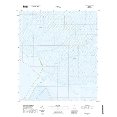
2020 Map of Plumb Bayou
USGS Topo · Published 2020About this map
Atchafalaya Bay and Fourleague Bay dominate the southwestern reaches of this coastal survey, where the terrestrial world gives way to the marshlands of southern Louisiana. The landscape is defined by a dense network of winding waterways such as Plumb Bayou, Creole Bayou, and Crooked Bayou, which carve through the wetlands to create isolated landmasses like Rainbow Island and Halters Island. The boundary between Terrebonne Parish and St. Mary Parish runs through these waters, marking a region where traditional land-based settlements are absent in favor of a purely aquatic environment. This map captures the intricate hydrography of the deltaic plain, illustrating how Creole Pass and various distributaries like Little Carencro Bayou and Bayou Sarian manage the flow of water toward the Gulf. It is a portrait of a dynamic environment where the distinction between land and water is constantly shifting.
Find a feature on this map
22 named features on this map. Tap any name to fly to it.
Don’t see what you’re looking for? This feature index may not catch every label — zoom into the map to look around manually.
Map Details
Editions of this 2020 Plumb Bayou Map
This is the sole edition of this map. No revisions or reprints were ever made.
Other maps of this area

1932 · Lake Decade
USGS Topo · 1:62,500

1935 · Morgan City
USGS Topo · 1:62,500

1941 · Belle Isle
USGS Topo · 1:62,500

1945 · New Orleans
USGS Topo · 1:250,000

1954 · Morgan City
USGS Topo · 1:62,500

1954 · Belle Isle
USGS Topo · 1:62,500

1957 · Lake Decade
USGS Topo · 1:62,500

1957 · Point Au Fer
USGS Topo · 1:62,500

1963 · New Orleans
USGS Topo · 1:250,000

1966 · New Orleans
USGS Topo · 1:250,000