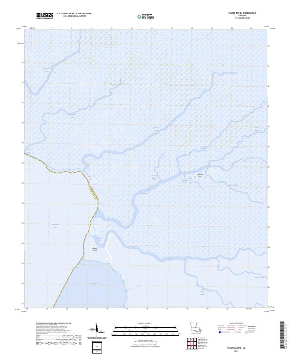
2024 Map of Plumb Bayou
USGS Topo · Published 2024About this map
Plumb Bayou winds through a dense network of coastal wetlands at the border of Terrebonne Parish and St. Mary Parish. This 2024 survey documents a complex system of waterways and landforms including Rainbow Island and Halters Island where the mainland meets the open water of Atchafalaya Bay. The landscape is defined by its hydrography, showing the intricate connections between Crooked Bayou, Palmetto Bayou, and Deer Island Bayou. In the southern reach of the quadrangle, Creole Pass serves as a vital opening between the bay and the interior marshes of Creole Bayou. The lack of road infrastructure and human settlements on this sheet underscores the preservation of this remote deltaic environment, where natural channels like Victors Bayou and Bayou Sorian continue to dictate the geography of the Louisiana coast.
Find a feature on this map
22 named features on this map. Tap any name to fly to it.
Don’t see what you’re looking for? This feature index may not catch every label — zoom into the map to look around manually.
Map Details
Editions of this 2024 Plumb Bayou Map
This is the sole edition of this map. No revisions or reprints were ever made.
Other maps of this area

1932 · Lake Decade
USGS Topo · 1:62,500

1935 · Morgan City
USGS Topo · 1:62,500

1941 · Belle Isle
USGS Topo · 1:62,500

1945 · New Orleans
USGS Topo · 1:250,000

1954 · Morgan City
USGS Topo · 1:62,500

1954 · Belle Isle
USGS Topo · 1:62,500

1957 · Lake Decade
USGS Topo · 1:62,500

1957 · Point Au Fer
USGS Topo · 1:62,500

1963 · New Orleans
USGS Topo · 1:250,000

1966 · New Orleans
USGS Topo · 1:250,000