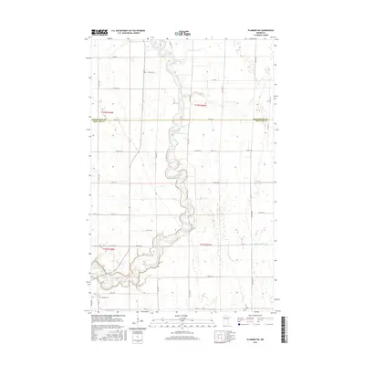
2016 Map of Plummer NW
USGS Topo · Published 2016About this map
The Red Lake River meanders heavily through this agricultural landscape on the border of Pennington and Red Lake counties. The river's serpentine path, characterized by tight oxbows and numerous cutoffs, dominates the central corridor of the map. This 2016 survey illustrates the precision of modern township and range surveying, with a rigid grid of roads such as Co Rd 54 and 110th Ave SE cutting across the fertile plains of the Red River Valley region. In the southwestern corner, Saint Josephs Cem serves as a primary genealogical landmark for local family researchers. The land use is almost entirely focused on large-scale farming, supported by drainage infrastructure like County Ditch Number Sixty, which channels water toward the primary river system. Local transit is defined by the intersection of several county highways, including Co Hwy 2 and Co Hwy 19.
Find a feature on this map
33 named features on this map. Tap any name to fly to it.
Don’t see what you’re looking for? This feature index may not catch every label — zoom into the map to look around manually.
Map Details
Editions of this 2016 Plummer NW Map
This is the sole edition of this map. No revisions or reprints were ever made.
Other maps of this area

1918 · Terrebonne
USGS Topo · 1:62,500

1918 · Red Lake Falls
USGS Topo · 1:62,500

1918 · Viking
USGS Topo · 1:62,500

1943 · Thief River Falls
USGS Topo · 1:62,500

1952 · Red Lake Falls
USGS Topo · 1:62,500

1952 · Grand Forks
USGS Topo · 1:250,000

1952 · Thief River Falls
USGS Topo · 1:250,000

1956 · Thief River Falls
USGS Topo · 1:250,000

1956 · Grand Forks
USGS Topo · 1:250,000

1957 · Thief River Falls
USGS Topo · 1:250,000