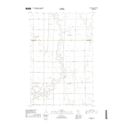
2019 Map of Plummer NW
USGS Topo · Published 2019About this map
The Red Lake River meanders sharply through this rural landscape on the border of Pennington and Red Lake counties. This agricultural region is defined by a rigid grid of section roads and drainage projects like County Ditch Number Sixty, which channel water across the flat terrain. For those researching local history or genealogy, the map identifies two significant burial sites in the southwestern corner: Saint Josephs Cem and Oak Grove Cem. These cemeteries, located near the intersection of Co RD 109 and Co RD 1, serve as primary landmarks for the small farming communities that have long worked these prairie lands.
Find a feature on this map
33 named features on this map. Tap any name to fly to it.
Don’t see what you’re looking for? This feature index may not catch every label — zoom into the map to look around manually.
Map Details
Editions of this 2019 Plummer NW Map
This is the sole edition of this map. No revisions or reprints were ever made.
Other maps of this area

1918 · Terrebonne
USGS Topo · 1:62,500

1918 · Red Lake Falls
USGS Topo · 1:62,500

1918 · Viking
USGS Topo · 1:62,500

1943 · Thief River Falls
USGS Topo · 1:62,500

1952 · Red Lake Falls
USGS Topo · 1:62,500

1952 · Grand Forks
USGS Topo · 1:250,000

1952 · Thief River Falls
USGS Topo · 1:250,000

1956 · Thief River Falls
USGS Topo · 1:250,000

1956 · Grand Forks
USGS Topo · 1:250,000

1957 · Thief River Falls
USGS Topo · 1:250,000