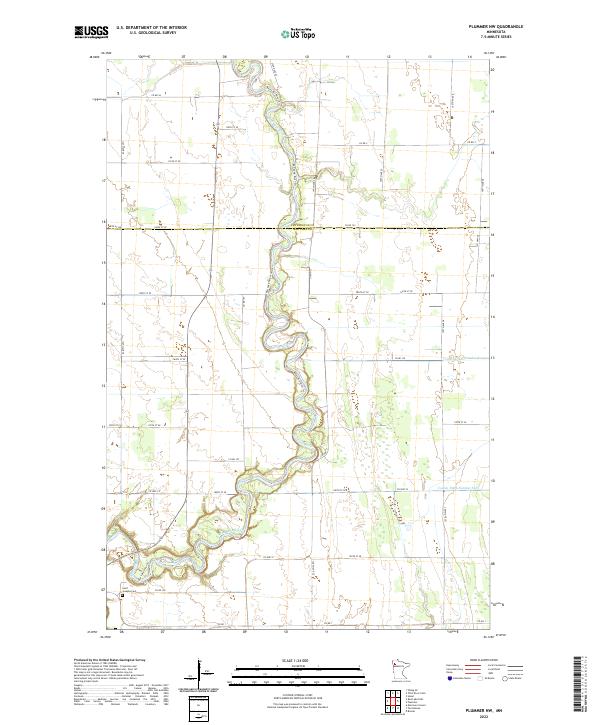
2022 Map of Plummer NW
USGS Topo · Published 2022About this map
Red Lake River snakes through the center of this rural landscape, carving a deep, meandering path that serves as the primary geographical anchor for the region. The map captures the transition across the Pennington Co Red Lake Co boundary, where the land is defined by an extensive grid of section-line roads and managed water systems. Agricultural drainage is evident through engineered features like County Ditch Number Sixty-two and County Ditch Number Sixty, which channel water away from the surrounding fields. Near the southern edge of the survey, Saint Josephs Cem stands as a quiet marker of the local community's history, situated along Co RD 109. The intricate loops of the river and the presence of the Red Lake River Trl indicate the waterway's continued importance for both navigation and recreation in this part of Northwest Minnesota.
Find a feature on this map
36 named features on this map. Tap any name to fly to it.
Don’t see what you’re looking for? This feature index may not catch every label — zoom into the map to look around manually.
Map Details
Editions of this 2022 Plummer NW Map
This is the sole edition of this map. No revisions or reprints were ever made.
Other maps of this area

1918 · Terrebonne
USGS Topo · 1:62,500

1918 · Red Lake Falls
USGS Topo · 1:62,500

1918 · Viking
USGS Topo · 1:62,500

1943 · Thief River Falls
USGS Topo · 1:62,500

1952 · Red Lake Falls
USGS Topo · 1:62,500

1952 · Grand Forks
USGS Topo · 1:250,000

1952 · Thief River Falls
USGS Topo · 1:250,000

1956 · Thief River Falls
USGS Topo · 1:250,000

1956 · Grand Forks
USGS Topo · 1:250,000

1957 · Thief River Falls
USGS Topo · 1:250,000