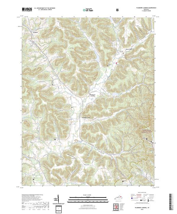
2022 Map of Plummers Landing
USGS Topo · Published 2022About this map
Plummers Landing serves as a central point in this landscape of deep hollows and timbered ridges, where the headwaters of Sand Lick Creek and Fox Creek carve through the terrain. The map illustrates a rural Kentucky settlement pattern defined by small family cemeteries and crossroads communities, such as Goddard near the Covered Bridge Rd and Muses Mills along the Greenbrier Br. The southeastern portion of the sheet transitions into the protected lands of the Daniel Boone National Forest, marked by steep elevations like Bishop Mtn and Sand Mtn. Genealogical value is particularly high here, as the map documents numerous small burial sites including Mount Vernon Cem, Point Pleasant Cem, and the Jackson Family Cem. These sites, often positioned on high ground above the creek beds, provide a clear spatial record of the families who settled these reaches of Fleming and Rowan Counties.
Find a feature on this map
111 named features on this map. Tap any name to fly to it.
Don’t see what you’re looking for? This feature index may not catch every label — zoom into the map to look around manually.
Map Details
Editions of this 2022 Plummers Landing Map
This is the sole edition of this map. No revisions or reprints were ever made.
Other maps of this area

1929 · Morehead
USGS Topo · 1:48,000

1929 · Salt Lick
USGS Topo · 1:62,500

1934 · Salt Lick
USGS Topo · 1:62,500

1935 · Morehead
USGS Topo · 1:62,500

1951 · Cranston
USGS Topo · 1:24,000

1951 · Hillsboro
USGS Topo · 1:24,000

1951 · Stricklett
USGS Topo · 1:24,000

1951 · Plummers Landing
USGS Topo · 1:24,000

1951 · Burtonville
USGS Topo · 1:24,000

1951 · Flemingsburg
USGS Topo · 1:24,000